+91-
Contact With Us!
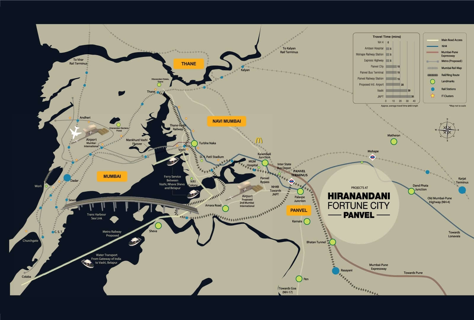
- Location : Panvel, Navi Mumbai
- Navi Mumbai International Airport
- 8 Lane Sion Panvel Expressway
- Water Transport from Radio Club Ferry Wharf to NMIA/Belapur
- Mumbai Trans Harbour Link
- Metro Link.
- Panvel-Karjat Route extended to passenger traffic, MUTP Phase-3. CST-Panvel Fast Suburban Corridor
Hiranandani Fortune City Location Map:
Hiranandani Developers is the most famous company that has not only completed private projects but also government properties. This time we will talk about the Hiranandani Fortune City Location Map. It is exactly situated in Panvel, Navi Mumbai and is bounded by so many infrastructures and buildings. Proposed Navi Mumbai International Airport is very close, while Pune-Mumbai Highway is also in the vicinity. For deliver a natural and green atmosphere, a lot of trees and plants are given. For the students, Hiranandani School provides lower to higher education.
Furthermore, Panvel is one of the most developed areas in the state of Maharashtra as it is the owner of various amusement parks, entertainment hubs, primary schools, manufacturing units, bus stands, metro station and international & domestic airport. Hiranandani Fortune City Panvel is enclosed by shopping complexes, laundry, ATMs, Banks, and wide road networks. City bus service is available round the clock, while you may take public buses for going anywhere. Therefore, you should buy your dream home in this residential apartment.
About Us | Location Map | Floor Plans | Master Plans | Video | Blog | News | Amenities | RERA Number
Disclaimer This website is not an official site and it belongs to the authorized channel partner for information purpose only.
 Instant Call Back
 Free Site Visit
 Unmatched Price
- Instant Call Back
- Free Site Visit
- Unmatched Price
- Instant Call Back
- Free Site Visit
- Unmatched Price
- Instant Call Back
- Free Site Visit
- Unmatched Price